About the Creator
Lars Larson graduated from IUPUI with a Master's Degree in Media Arts & Science, with an emphasis on using data visualization to create virtual reality environments.
From a very young age, Lars has loved learning about science, history, and cultures. In elementary school his favorite television programs were Jacque Cousteau documentaries, "Connections" with James Burke, and "NOVA." As a youth he lived in the Philippines, where he learned a language and became comfortable in another culture.
Lars also loves the outdoors, having done a bit of backpacking, kayaking, and camping. He takes his camera on every trip. "I love being out and doing things, but for me, it's about the image. It's important to have good visual documentation," he says.
This project has allowed Lars to combine his interests in the outdoors, history, culture, photography, and visual media.
"I am excited to be able to combine so many of my interests into a project that is not only relevant, but beautiful. It has been a very interesting experience."
Lars lives in Avon, Indiana, with his wife and three children.
Technology
This project was created on a Macbook Pro 17-inch laptop computer with a 2.66 GHz Intel Core i7 processor, 4 GB of 1067 MHz DDR3 RAM, and an NVIDIA GeForce GT 330M 512 MB video card. When working at home, a dual-monitor setup was used. The second monitor is a ViewSonic VG2230WM connected to the laptop with a 15-pin VGA-to-Mini Display Port adapter. The operating system to begin with was OS X 10.6.7 "Snow Leopard", but was later upgraded to OS X 10.8.5 "Mountain Lion." All of the 3D work was done with Mountain Lion.
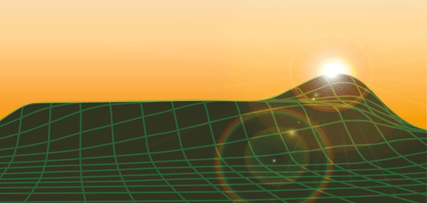
ArcGIS 10.1 from ESRI was used to process the Glenn Black survey data to a greyscale height map. ArcGIS is not made to run on the Apple computer, so university-owned PC computers running windows 8 were used for this step.
Maya 2013 from Autodesk was used to create the initial terrain model and the 3D assets and textures.
Unity 3D version 4.3.4f1 was used to create the final, 1st-person, interactive product.
Photoshop CS4 Extended was used to make 3D textures, web graphics, and to process photos. Also used to layer different maps together to lay out locations of various features in the scene.The Photomerge (panorama) feature of Photoshop was used to create the long, thin textures for the posts and trees in the 3D scene.
Adobe Illustrator CS4 was used to lay out and composite maps of the site, and draw the palisade wall outlines from which the palisades were modeled. Also used to create the artwork for the business card and marketing materials.
Canon EOS Rebel XS digital SLR camera with EFS 18-55 mm and EFS 55 -250 mm zoom lenses with image stabilizer, used for photographing the site, making 3D textures, and documentation.
Western Digital My Passport 1tb external hard drive for file backup.
iPhone 5C for photos, video, voice dictation, keeping time, driving directions, messaging, phone, email.
Google Earth maps. Used for placement of 3D objects, checking accuracy of 3D terrain scale, and calculating distances.
Numbers spreadsheet program for Mac. Used to keep track of expenses, web sites, mileage, and time spent on the project.
Microsoft Excel spreadsheet program for studying the Glenn Black 1930s survey data.
Pages for Mac, a word processing program.
Google Chrome was used for the internet, except in one case where a 64-bit browser was needed, and then Safari was used, as Chrome did not support 64-bit technology.
iPhoto, a photo management tool. It is very nice for sorting and browsing images, but extremely difficult for accessing image files and directories.
Komodo Edit is a free, open-source code editor, which was used to edit this web site.
Cyberduck is a free, open-source FTP client.
Dropbox is a drag-and-drop file sharing application that makes it easy to share large files.
FontBook for managing and browsing fonts.
Network Connect VPN utility for connecting to IUPUI computers from outside locations.
1&1 web hosting site was used as an off-site storage facility for project files.